
Independent editorial guide
Best Hiking Trails Near Ioannina: Gorges, Villages and Mountain Routes (2026)
Which Ioannina-area hike suits your day?
Start with the Koukouli–Kipi bridge circuit for Zagori’s stone villages, Vradeto Steps and Beloi for historic paths and gorge views, or Monodendri–Stone Forest–Oxia for limestone formations and a transferred return. Vikos Gorge is a fuller crossing; Drakolimni is the alpine-lake objective. Mitsikeli rises above the Ioannina basin, while Syrrako–Kalarrytes and Ursa Trail take you into Tzoumerka and Metsovo. For an urban outing, the Pamvotida lakefront is a separate walking alternative.
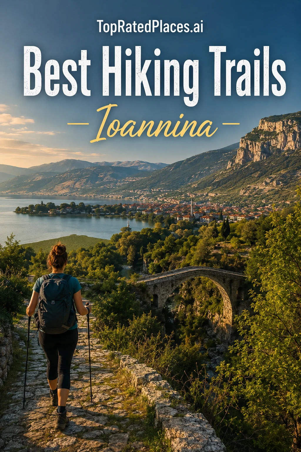
How to use this shortlist
These best-for recommendations compare named hikes in the wider Ioannina/Epirus excursion area by landscape, route commitment and return logistics. Zagori, Tymfi, Tzoumerka and Metsovo require travel beyond the city. We distinguish the stated operator route from other paths with a similar name, and keep the city lakefront walk outside the mountain-hike shortlist. Published times are examples for the named variant, without a measured quality or safety ranking or an inspection of current conditions.
Compare the landscape, route example and return
| Trail | Choose it for | Published route example | Return or key condition |
|---|---|---|---|
| Vikos Gorge Trail | A full day among Vikos Gorge’s limestone walls | Monodendri–Vikos: destination guide lists 12.5km, six–eight hours | Different endpoints; arrange return transport |
| Drakolimni of Tymfi Trail | An alpine-lake objective above Papigo | Geopark: 8km/four-and-a-half hours to lake; eight–nine-hour return description | Allow the return and arrange any refuge stay separately |
| Voidomatis Springs Trail | A springs-focused hike from Papigo to Vikos | Mountain Goat springs route: 8km, four–five hours | Through-route with local transfer; family age wording conflicts |
| Kapesovo Vradeto Steps Beloi Viewpoint Trail | The historic Vradeto staircase and Beloi panorama | Guided steps/Beloi product: about three-and-a-half hours | Meeting point, walking direction and local transfer are distinct |
| Zagori Stone Bridges and Kipi Koukouli Trail | A circular walk through Zagori’s stone-bridge landscape | Ecomuseum: 4.9km circular, three–four-hour guided outing | Starts and finishes at Koukouli; steps and stone surfaces |
| Mount Mitsikeli Refuge and Summit Trail | A mountain outing above the Ioannina basin | Club routes: Lingiades turn–refuge; refuge/summit continuation | Refuge visit versus summit; hut service by arrangement |
| Syrrako Kalarrites Path | Tzoumerka’s linked stone villages and ravine scenery | Trekking Hellas longer circuit: 12km, six-and-a-half hours | Direct connector differs from the circuit returning to Kalarrytes |
| Ursa Trail Metsovo | Metsovo forest and ridge walking on a named trail system | Trekking Hellas: 9km/four-hour guided loop | Choose the section; guided product and running race differ |
| Monodendri Stone Forest Oxya Trail | Limestone formations and the Oxia gorge panorama | Ecomuseum: 4.2km one way; one–two-hour guided product | Oxia finish; return transfer included only in the booked product |
For stone bridges, historic paths and gorge viewpoints
-
Kapesovo Vradeto Steps Beloi Viewpoint Trail
The historic Vradeto staircase and Beloi panorama
Choose Vradeto Steps and Beloi for stone-path craftsmanship and a panorama into Vikos Gorge. Kapesovo–Vradeto is the staircase ascent; adding Beloi extends it. The Mountain Goat guided product estimates three-and-a-half hours and includes a local transfer, with a Kapesovo meeting point.
Sources: Visit Greece: Skala Vradetou hiking, Mountain Goat: Vradeto Steps and Beloi via Discover Greece, Northern Pindos National Park: Vikos canyon
-
Zagori Stone Bridges and Kipi Koukouli Trail
A circular walk through Zagori’s stone-bridge landscape
Choose the Koukouli–Kipi circuit for a heritage walk that returns to its starting village. Ecomuseum’s 4.9km itinerary links Kokkoris, Captain Arkoudas, Plakidas, Mylos and Kondodimos bridges, Kipi and the Koukouli steps; its guided version is a three–four-hour half day.
-
Monodendri Stone Forest Oxya Trail
Limestone formations and the Oxia gorge panorama
Choose Monodendri–Stone Forest–Oxia for weathered limestone formations and a view over Vikos Gorge without a full gorge crossing. Ecomuseum’s 4.2km route ends at Oxia; its one–two-hour guided product includes transfer back to Monodendri. An independent walk needs its own return arrangement.
Sources: Ecomuseum Zagori: Monodendri–Stone Forest–Oxia, Northern Pindos National Park: Vikos canyon
For a gorge crossing or the Voidomatis springs
-
Vikos Gorge Trail
A full day among Vikos Gorge’s limestone walls
Choose Vikos Gorge for a substantial day below Zagori’s limestone walls. The classic Monodendri–Vikos crossing is a through-hike with a climb out at the finish. Discover Greece gives a six–eight-hour example; choose the exact start and direction and arrange transport from the finish.
Sources: Discover Greece: Vikos Gorge hiking, Northern Pindos National Park: Vikos canyon
-
Voidomatis Springs Trail
A springs-focused hike from Papigo to Vikos
Choose the springs route for a descent from Papigo into the gorge, then the climb to Vikos village. Mountain Goat lists an eight-kilometre, four–five-hour guided version with local transfer. This is a different walk from its six-kilometre lower-river product meeting at Klidonia bridge.
Sources: Mountain Goat: Papigo to Vikos via Voidomatis springs, Mountain Goat: Papigo–springs–Vikos Greek itinerary, Mountain Goat: lower Voidomatis River Trail, Mountain Goat river-walk listing via Discover Greece
For a mountain ascent or alpine-lake objective
-
Drakolimni of Tymfi Trail
An alpine-lake objective above Papigo
Choose Drakolimni for alpine meadows and the high lake beneath Tymfi’s peaks. The geopark lists Mikro Papigo–lake as eight kilometres and four-and-a-half hours one way, and describes an eight–nine-hour return excursion separately. The refuge is an intermediate stop, not the end of the lake hike.
Sources: Vikos–Aoos Geopark: hiking routes, Vikos–Aoos Geopark: geological routes, Astraka Mountain Hut: route and service questions, Epirus Adventures: Alpine Dragon Lake Hike via Discover Greece
-
Mount Mitsikeli Refuge and Summit Trail
A mountain outing above the Ioannina basin
Choose Mitsikeli for a mountain objective close to the Ioannina basin. The local mountaineering club identifies the Lingiades-turn–refuge O3 route and a refuge–summit continuation. Decide whether the outing ends at the refuge or continues to the 1,810m summit; a hut listing does not reserve a staffed stay.
Sources: Ioannina Mountaineering Club: route archive, Ioannina Mountaineering Club: Mitsikeli refuge, Ioannina Mountaineering Club: current information, Ioannina Mountaineering Club: 2026–2027 programme
For Tzoumerka villages or Metsovo forests
-
Syrrako Kalarrites Path
Tzoumerka’s linked stone villages and ravine scenery
Choose Syrrako–Kalarrytes for stone villages and the Chrousia ravine landscape in Tzoumerka. The historic connector is distinct from Trekking Hellas’ twelve-kilometre, six-and-a-half-hour circuit via waterfalls and Quiassa mill, starting and finishing at Kalarrytes. This is a regional excursion from Ioannina.
Sources: Visit Greece: outdoor activities in Tzoumerka, Trekking Hellas: Syrrako–Kalarrytes circuit
-
Ursa Trail Metsovo
Metsovo forest and ridge walking on a named trail system
Choose an Ursa Trail section for Metsovo’s black-pine, oak and beech woods and ridge scenery. The full trail is forty kilometres; Trekking Hellas offers a separate nine-kilometre/four-hour guided loop via Karakoli and Politsioura. Pick the intended section rather than using the shorter product’s figures for the whole trail.
Sources: Ursa Trail: walking system around Metsovo, Trekking Hellas: nine-kilometre Ursa section
Lake Pamvotida for a city walking alternative
Lake Pamvotida is the city alternative when a mountain excursion does not suit the day. Walk a chosen lakefront section among parks and lake views, with cafés nearby. Island boat trips are separate, and the municipal description does not establish a complete or uniformly step-free lakeside circuit.
Sources: Travel Ioannina: Lake Pamvotida
Build the day around the exact route
For a compact heritage outing, start with the circular Koukouli route. For a viewpoint walk, choose steps and Beloi or the Stone Forest/Oxia itinerary, allowing the stated extension or transfer. For a substantial mountain day, compare the full Vikos crossing, the climb toward Drakolimni or the specific Mitsikeli ascent with your group’s experience.
Before setting out, obtain the current route/map, weather and local condition advice, sufficient daylight, suitable footwear and water, and a clear return plan. Use qualified local guidance when the route or conditions exceed your experience. Provider age rules, difficulty labels and seasonal service windows apply to the named itinerary; they do not guarantee suitability for every guest.
Questions before you choose
Are all these hikes short walks inside Ioannina?
No. Mitsikeli is above the Ioannina basin, while Zagori/Tymfi, Tzoumerka and Metsovo are regional excursions. The Pamvotida lakefront is shown separately as the city walking alternative, with a chosen shoreline section rather than an assumed full-lake circuit.
Is Monodendri–Stone Forest–Oxia automatically circular?
No. Ecomuseum’s 4.2km itinerary ends at Oxia and includes a transfer back in its guided product. An independent outing needs a separate return arrangement.
Does the nine-kilometre Ursa walk cover the entire trail?
No. The full Ursa Trail is forty kilometres. Trekking Hellas’ nine-kilometre/four-hour loop is a specific guided section with its own start, age and fitness rules and participant-dependent prices; the running event is separate.
Is Syrrako–Kalarrytes always a six-and-a-half-hour hike?
No. That duration belongs to Trekking Hellas’ twelve-kilometre circuit with additional waterfall/mill stops and a return to Kalarrytes. The direct village connector is a different plan.
Does a Mitsikeli refuge listing mean the hut is open for my stay?
No. The local mountain club describes the refuge and its approach routes, but staffed service, supplies and an overnight place for your date still need a direct arrangement. Club-office hours are different from hut operation.
Can I use an easy or family label as a suitability guarantee?
No. Labels describe a source’s itinerary and assumptions. Current surfaces, exposure, weather, fitness and access needs matter. Mountain Goat’s springs pages even differ on minimum age—twelve-plus in English and seven-plus in Greek—so obtain its current rule before arranging a family booking.
How we selected these places
Official destination/geopark material, local mountain-club information and specific route-operator descriptions were reviewed on 18 October 2026. We compared positive route identity, landscape, start/finish, one-way versus return commitment and material product conditions. The groups are editorial recommendations for different plans, without trail attendance, GPX testing, live booking checks, invented ratings or a universal difficulty score.
Sources and review dates
- Discover Greece: Vikos Gorge hiking — Greek tourism-sector destination guide — checked 2026-10-18. Classic crossing, seasonal advice and return transport; route variants differ.
- Northern Pindos National Park: Vikos canyon — National park information — checked 2026-10-18. Gorge identity and the viewpoints at Beloi and Oxia.
- Vikos–Aoos Geopark: hiking routes — Geopark route information — checked 2026-10-18. Mikro Papigo–Drakolimni is listed as eight kilometres and four-and-a-half hours one way, with high difficulty.
- Vikos–Aoos Geopark: geological routes — Geopark route information — checked 2026-10-18. Papigo–Drakolimni return is described as eight–nine hours; some summary fields elsewhere on the page conflict.
- EAGME: Vikos–Aoos geotrail catalogue — Hellenic geological survey — checked 2026-10-18. Named geotrails; summary distances and times differ from other published itineraries.
- Astraka Mountain Hut: route and service questions — Route operator information — checked 2026-10-18. Mikro Papigo ascent, onward lake walk, water preparation and normal May–October hut season; exact annual dates and beds separate.
- Epirus Adventures: Alpine Dragon Lake Hike via Discover Greece — Provider itinerary on Discover Greece — checked 2026-10-18. Nine-hour guided return example, Mikro Papigo meeting point and age/fitness requirements.
- Mountain Goat: Papigo to Vikos via Voidomatis springs — Route operator information — checked 2026-10-18. English itinerary: eight kilometres/four–five hours, downhill and uphill, ages twelve and above.
- Mountain Goat: Papigo–springs–Vikos Greek itinerary — Route operator information — checked 2026-10-18. Same named route; Greek page gives age seven+, different grade/elevation wording and explicit return transfer. Family eligibility needs operator resolution.
- Mountain Goat: lower Voidomatis River Trail — Route operator information — checked 2026-10-18. Separate six-kilometre/two-and-a-half-hour lower-river product meeting at Klidonia bridge.
- Mountain Goat river-walk listing via Discover Greece — Provider itinerary on Discover Greece — checked 2026-10-18. Listing mixes springs/Vikos highlights with a lower riverside description; direct operator products distinguish them.
- Visit Greece: Skala Vradetou hiking — Greek National Tourism Organisation — checked 2026-10-18. Historic stone staircase from Kapesovo to Vradeto; some sections lack guardrails.
- Mountain Goat: Vradeto Steps and Beloi via Discover Greece — Provider itinerary on Discover Greece — checked 2026-10-18. Three-and-a-half-hour product; Kapesovo meeting, guide/poles/local transfer, age ten+; walking direction described from Vradeto.
- Ecomuseum Zagori: Koukouli–bridges–Kipi circuit — Route operator information — checked 2026-10-18. 4.9km circular route, three–four-hour guided product with museum visit and light lunch.
- Travel Ioannina: Lake Pamvotida — Ioannina municipal tourism — checked 2026-10-18. Municipal information supports city lakefront parks and walks; no full-lake circuit or step-free guarantee.
- Ioannina Mountaineering Club: Mitsikeli refuge — Local mountain club — checked 2026-10-18. Apostolos Vertodoulos refuge: operator lists 1,290m, twenty-eight places, kitchen and toilet. Availability is separate.
- Ioannina Mountaineering Club: route archive — Local mountain club — checked 2026-10-18. O3 Lingiades-turn/refuge and refuge/summit identities; archive labels include winter ascents. Files were not downloaded or tested.
- Ioannina Mountaineering Club: current information — Local mountain club — checked 2026-10-18. Current club contact and activity information; club office hours are not hut opening times.
- Ioannina Mountaineering Club: 2026–2027 programme — Local mountain club — checked 2026-10-18. The club’s 2026–2027 programme lists refuge activities; overnight arrangements are separate.
- Visit Greece: outdoor activities in Tzoumerka — Greek National Tourism Organisation — checked 2026-10-18. Identifies the historic Syrrako–Kalarrytes connection.
- Trekking Hellas: Syrrako–Kalarrytes circuit — Route operator information — checked 2026-10-18. Twelve-kilometre/six-and-a-half-hour circuit; minimum four, age over six and basic fitness; guide, tax and liability insurance.
- Ursa Trail: walking system around Metsovo — Route operator information — checked 2026-10-18. Forty-kilometre trail and four sections, trail management and recorded 2016 recognition; race information is separate.
- Trekking Hellas: nine-kilometre Ursa section — Route operator information — checked 2026-10-18. Four-hour guided loop, participant-dependent per-person prices, age seven+, guide/poles/taxes/liability insurance.
- Ecomuseum Zagori: Monodendri–Stone Forest–Oxia — Route operator information — checked 2026-10-18. 4.2km one-way itinerary, one–two-hour guided product, escort/snack and return transfer from Oxia.
Author and corrections
Sarah Haddad is responsible for this guide. It is based on the published sources cited here; no firsthand visit or independent service test is claimed.